
Precipitation
Unlike temperature, which is expected to increase in all regions and all seasons, precipitation has more variable trends. For example, when looking at the average for the province as a whole, increases are expected annually, but these increases will be marked in winter while in summer little change is expected (Figure 1).
Several precipitation-related climate indicators are available on:
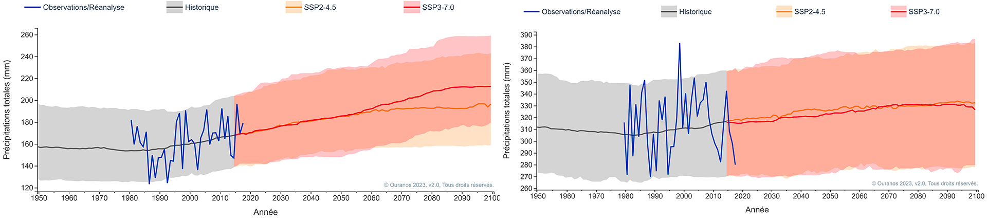 Figure 1 : Change in precipitation throughout Quebec from 1950 to 2100 in winter (left) and summer (right).The SSP2-4.5 is a moderate GHG emissions scenario, the SSP3-7.0 is a high scenario. Taken from the Ouranos Climate Portraits based on CMIP6.
Total liquid precipitation is also expected to increase in spring and fall across Quebec (Figure 2). This is mainly due to higher temperatures, which are causing a change in the state of precipitation from snow to rain. The change in the state of precipitation has impacts on water management and hydrology and is reflected, in particular, in earlier spring floods and a risk of flooding that persists later in autumn.
Every region of Quebec can also expect significant increases in all indices of heavy and extreme precipitation, in terms of both quantity and frequency. For example, an annual maximum precipitation event that historically had a 5% chance of occurring every year, may, in the future, around 2046—2065, have a 10% to 14% chance of happening every year. Knowing that extreme rain events often have major impacts, these results point to the need to adapt infrastructure and land use planning to these changes.
Pour en savoir plus sur l'impact des changements climatiques sur les risques d'inondations.
Learn more about the impact of climate change on water availability and flood risk.
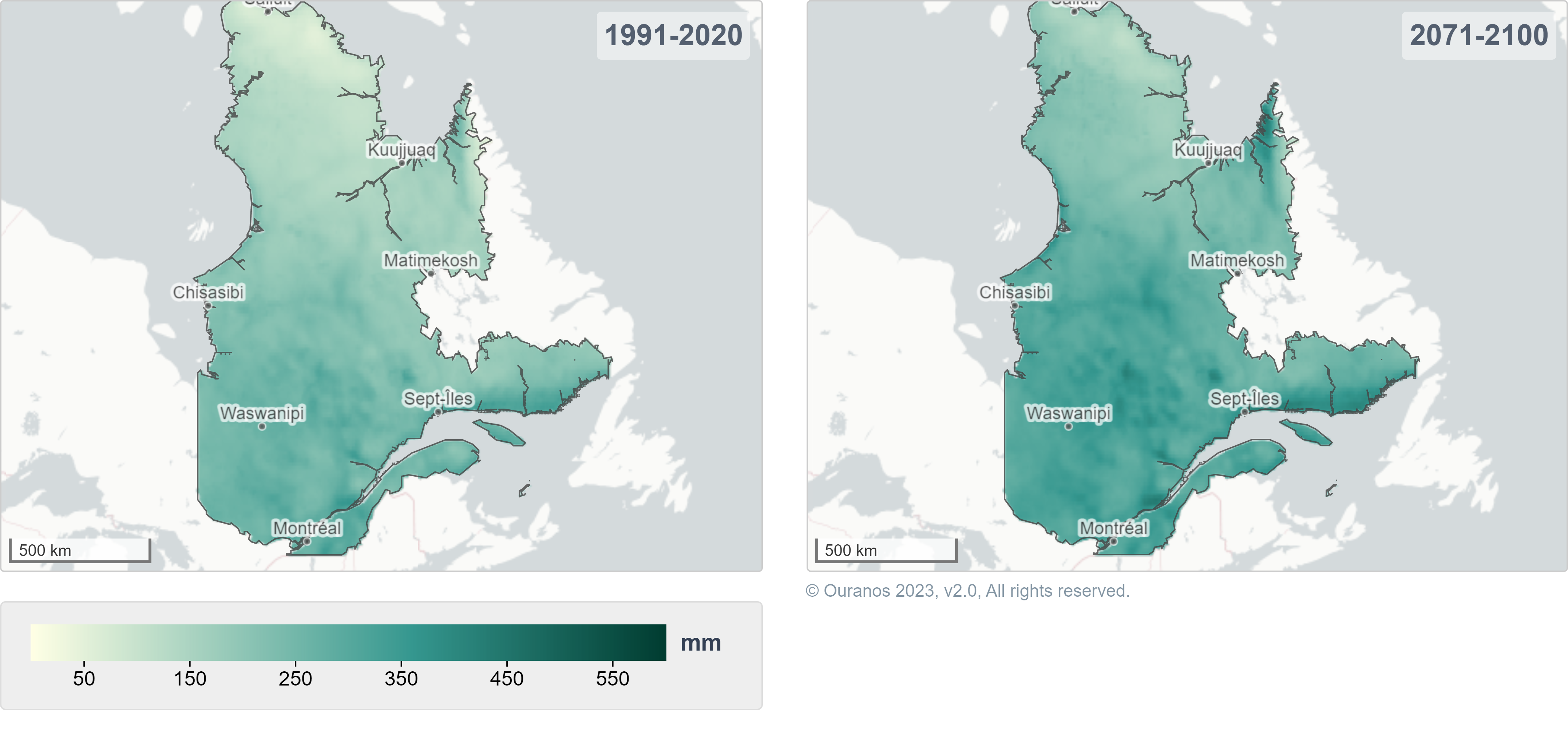
Figure 2 : Total fall liquid precipitation for the historical period 1991–2020 (map on the left) and for the future period of 2071–2100 based on a high GHG emissions scenario (map on the right). Taken from the Ouranos Climate Portraits based on CMIP6.