
This year’s hurricane season, which has just begun and officially lasts until the end of November, promises to be particularly active and could potentially hit records. This forecast, widely supported by experts, is based on several key factors.
Temperatures in the North Atlantic Ocean have reached unprecedented levels over the past year, which, combined with the possible return of La Niña to the equatorial Pacific, could increase hurricane activity in 2024.
Hurricane Beryl: Exceptionally powerful and early for hurricane season
Hurricane Beryl developed early, at the end of June, and intensified very rapidly over the Canada Day weekend to reach Category 4, the second highest category on the Saffir-Simpson scale. This scale classifies hurricane intensity based on maximum wind speed and potential property damage. Never before has a hurricane of this intensity been observed so early in the season.
At the time of writing, at least 11 people are reported dead after Beryl’s passage through the Caribbean islands. Its trajectory continued towards Mexico’s Yucatán Peninsula before making landfall in Texas early Monday morning (July 8, 2024). US authorities are on high alert as Beryl triggers major storm surges, heavy rainfall and destructive wind gusts in the southeastern United States, depriving more than 2 million homes of electricity and causing at least one death.
Record-breaking warming of the Atlantic fuelling an active hurricane season
Hurricanes that form in the Atlantic originate from atmospheric disturbances called African easterly waves. These waves originate off the coast of Africa and continue their journey to the west. To turn into tropical storms and hurricanes, these waves require warm enough water, with a temperature above 26.5°C, over an extended period of time.
2023 and 2024 were marked by record-breaking surface temperatures in the Atlantic, especially in the tropics, which favours the formation and development of storms and hurricanes. The high temperatures recorded are an important indicator of an active and intense season this year.
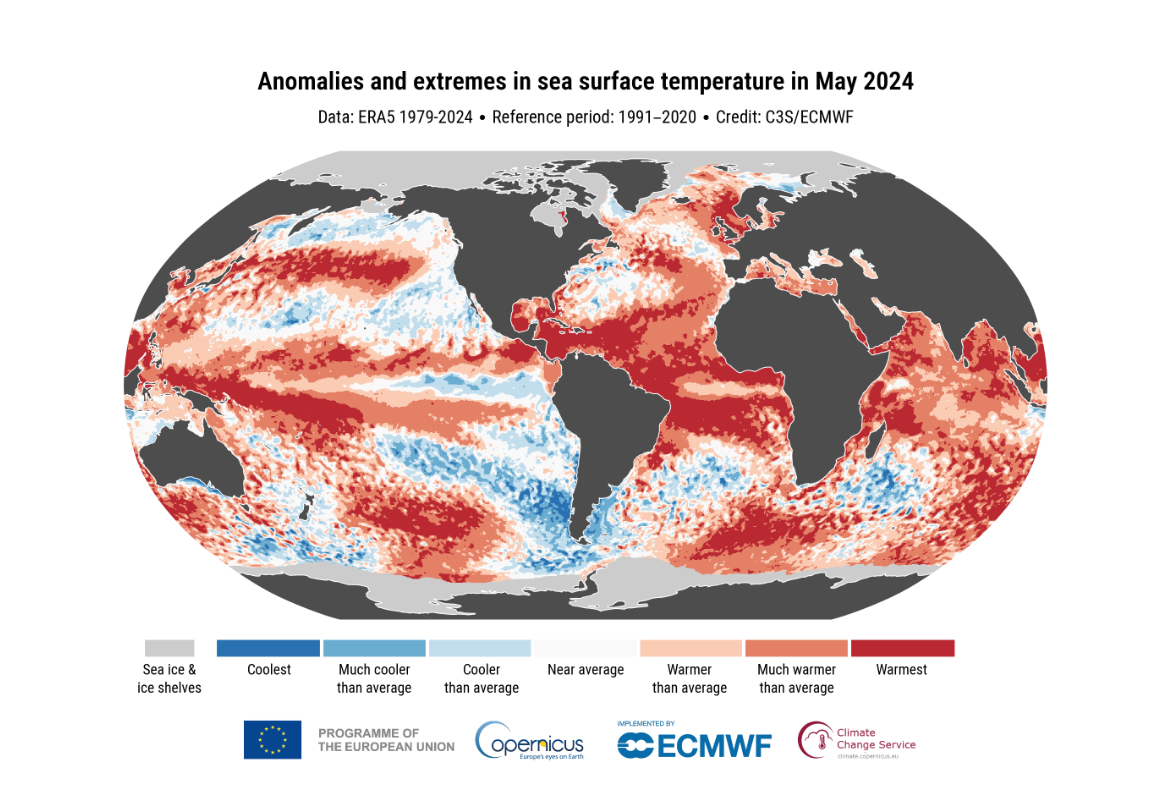
Figure 1 : Anomalies and extremes in sea surface temperature in May 2024.
The possible return of La Niña and its influence on the hurricane season
The possible return of La Niña could also contribute to intensifying the hurricane season. La Niña is generally accompanied by a decrease in tropical activity in the Pacific, but an increase in the Atlantic.
In addition, during La Niña episodes, high-altitude winds in the tropical Atlantic are generally weaker. This leads to a decrease in vertical wind shear, which is the difference between surface and high-altitude winds. These conditions create an environment that is more conducive to the development and intensification of hurricanes.
Forecast for the 2024 Atlantic hurricane season
According to data from the Barcelona Supercomputing Center - Centro Nacional de Supercomputación (BSC-CNS),which publishes seasonal predictions from more than 25 centres around the world, the 2024 hurricane season is expected to be worse than any since the platform began operating in 2016.
Seasonal forecasts also estimate an average of 11 hurricanes, a figure higher than the average of seven hurricanes usually observed per season. BSC-CNS also predicts a record number of major hurricanes, i.e. categories 3 to 5 on the Saffir-Simpson scale. Five major hurricanes are anticipated, which is the highest figure ever recorded by the platform.
For comparison, the largest number of major hurricanes observed during a season is seven, which occurred first in 2005 and then again in 2020. In 2005, four of these major hurricanes— Dennis, Katrina, Katrina, and Wilma—hit the continental United States, causing property damage estimated at around 165 billion US dollars.
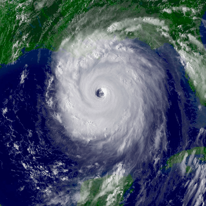
Figure 2 : Satellite image of Hurricane Katrina in 2005, making landfall on the U.S. east coast (from the NOAA, n.d.)
Communities and infrastructure at risk in coastal areas
Although it’s impossible to project the trajectory that hurricanes may take months in advance, the fact remains that a more active and intense season means a greater number of hurricanes are likely to make landfall.
The coastal regions of the North Atlantic, including the Caribbean and the east coast of the United States, are particularly at risk this season. These communities will need to prepare for potentially devastating impacts, with increased risks of heavy rains, floods, high winds and storm surges. Communities and coastal infrastructure, already under pressure due to rising sea levels, could suffer significant damage.

Figure 3 : Aftermath of Hurricane Fiona in Canada’s Atlantic provinces in 2022 (from Canadian Underwriter, 2022).
Although current data does not allow for an accurate forecast of the risks in eastern Canada and Quebec, it would be wise to be cautious. The events of the last few years have shown that these regions are not immune to hurricanes. Fiona, which hit the Atlantic provinces in 2022, is a striking example.
Preparation is the key to adaptation
Faced with the announcement of a particularly active and intense season, preparation is more important than ever. Coastal regions must mobilize to minimize potential damage and protect the most vulnerable communities.
By taking preventive measures, strengthening our warning and monitoring systems, and raising public awareness of storm safety guidelines, we can collectively improve our ability to anticipate and respond to these extreme weather events.