
Sea level rise
Given the impacts of sea level rise, adaptation is essential to ensure the health and safety of communities, preserve infrastructure, and strengthen the resilience of coastal ecosystems.
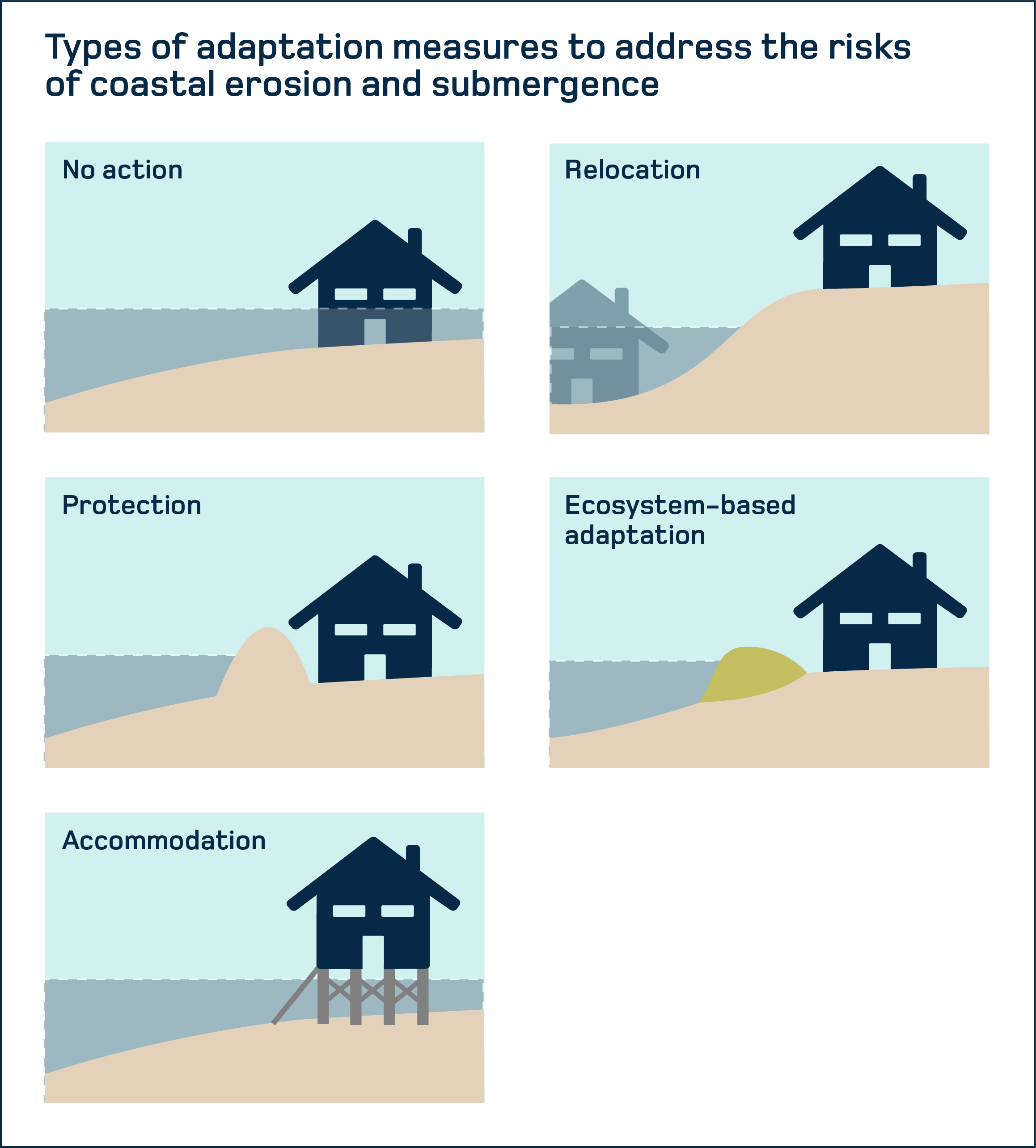
Physical adaptation measures to sea level rise generally fall into five broad categories:
Non-intervention (in some cases), which consists of taking no action.
Relocation, which involves moving buildings, resources or even communities out of the area at risk.
Protection, which generally consists of establishing a physical barrier between land and water, such as rockfill or dykes.
Ecosystem-based adaptation, which involves developing natural environments by methods such as the revegetation of riverbanks or salt marshes to allow water to enter the soil.
Accommodation, which consists of creating infrastructure in coastal areas to facilitate the passage of water.
Beach nourishment and relocation of a historic building in La Grave
The coastline of the Magdalen Islands is already experiencing significant climate change impacts, mainly due to sea level rise.
To cope with this climate hazard, a cost-benefit analysis was carried out in order to determine the most appropriate adaptation solution. Beach nourishment was selected because it was found to be the most beneficial to the local area. The main elements that led to the choice of this measure were:
The relatively low implementation cost
The increase in the use value of the coastline
The beach’s location in an area with a rich cultural and historical heritage
In 2021, in La Grave, more than 75,000 tonnes of granular materials were spread along 640 metres, and a historic commercial building was also moved. Four years later, beach nourishment is still playing its protective role, despite the effects of post-tropical storm Fiona in 2022.
Research project | Cost-benefit analysis of adaptation options in coastal areas of the Magdalen Islands
The results of this project supported municipalities and stakeholders in their efforts to better manage coastal developments and assets over the long term, and to justify certain preventive interventions, particularly in the Magdalen Islands.
Understanding groundwater salinization
The O’Salis project, led by a team of researchers from the Université du Québec à Rimouski, is assessing the risks of the salinization of coastal groundwater resources in the Lower St. Lawrence and the Gaspé Peninsula. With rising water levels and recurring coastal flooding, salt water intrusion threatens the groundwater resources used by 50% of the population for fresh water.
Phase 1 of this initiative included:
Analysis of water from a hundred private wells to detect possible salt water infiltration
Prediction of the areas that will be most vulnerable to coastal submergence by 2055 and 2100, based on climate modelling
Dialogue with residents and local stakeholders, which has fostered understanding of the risks associated with salinization
The second phase of the project, O’Salis 2.0, will strengthen the public’s climate resilience by documenting and mitigating the effects of the salinization of groundwater sources and by preventing its impacts on human health.